
Hurricane Erin has rapidly grown into one of the most powerful storms of the 2025 Atlantic hurricane season, unleashing dangerous conditions while staying just north of the Caribbean. The system intensified at an alarming pace, briefly reaching Category 5 strength before weakening slightly, but it continues to pose serious risks across the region and beyond.
Rapid Intensification Turns Erin Into A Major Threat
Hurricane Erin became the first hurricane of the 2025 Atlantic season and quickly escalated into a major storm. Initially forming as a disturbance known as Invest 97L, the system strengthened rapidly once conditions became favorable.
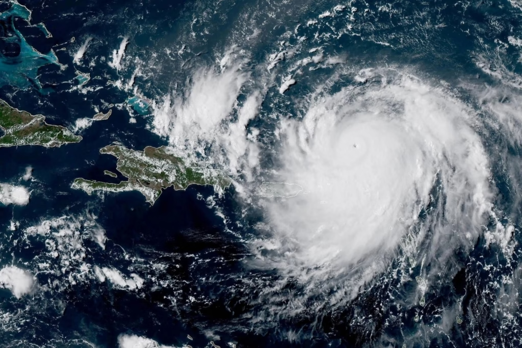
Shortly after intensification began, Hurricane Hunters confirmed the storm had surged to Category 5 strength. Winds peaked at 160 mph, placing Erin at the highest level on the Saffir-Simpson Hurricane Wind Scale.
However, the storm has since weakened slightly. It is now categorized as a Category 3 hurricane, though it continues reorganizing and remains extremely dangerous.
Storm Tracks North Of Caribbean Islands
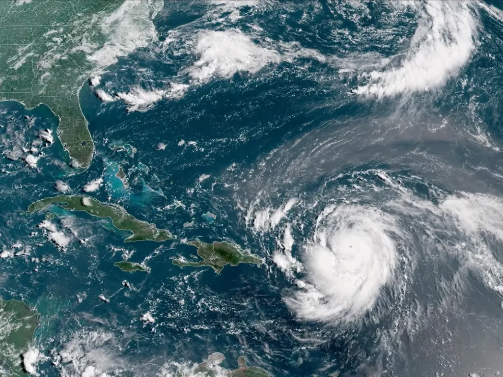 As Erin moves across the Atlantic, it is passing to the north of the Caribbean islands. This track has helped spare the region from a direct hit, but impacts are still being felt.
Bands from the hurricane have already lashed parts of the northern Caribbean. Rainfall totals between 2 and 4 inches are expected, with isolated areas potentially receiving up to 6 inches.
Meanwhile, hazardous conditions continue to develop along coastal regions. Large waves and dangerous surf are expected to reach parts of the southeastern coastline in the coming days.
Flooding And Landslide Risks Remain High
Despite staying offshore, Erin continues to bring life-threatening conditions. Heavy rainfall and unstable terrain raise concerns across impacted areas.
“Locally considerable flash and urban flooding, along with landslides or mudslides, are possible,” the National Hurricane Center said.
That said, emergency officials are closely monitoring the situation as conditions remain favorable for the hurricane to maintain its strength over the western Atlantic.
Watches Issued As Storm Continues Path
Authorities have issued a Tropical Storm Watch for the Turks and Caicos and parts of the southeastern Bahamas. While the storm’s core is expected to remain offshore, its outer bands could still bring significant weather impacts.
Residents in affected regions are urged to stay alert. Even without a direct landfall, strong winds, heavy rain, and coastal flooding can create dangerous situations.
A Deadly Start Before Becoming A Hurricane
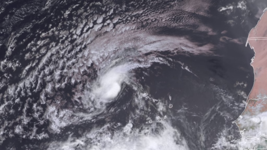
 Before Erin was officially named, the system already caused devastation. As Invest 97L, it brought heavy rainfall to the Cabo Verde islands.
The early impacts were severe, leading to multiple deaths and widespread flooding damage. This underscores how dangerous tropical systems can be, even before reaching hurricane status.
Atlantic Season Activity Beginning To Build
So far, the 2025 Atlantic hurricane season has produced four tropical storms, Andrea, Barry, Chantal, and Dexter. Erin now marks the first hurricane and the first major storm of the season.
In contrast, forecasters are also monitoring additional areas in the eastern and central Atlantic. Development in those regions is not expected immediately, but conditions could change over the coming week.
If another system forms, the next name on the list will be Fernand.
Peak Hurricane Season Still Ahead
The Atlantic hurricane season traditionally reaches its peak around September 10. Activity typically remains elevated through November before tapering off.
Meanwhile, Hurricane Erin serves as an early reminder of how quickly storms can intensify and how dangerous they can become, even without making direct landfall.